0000 thomas ridge loopGreen Mountain, NC 28740
0000 thomas ridge loopGreen Mountain, NC 28740
Description
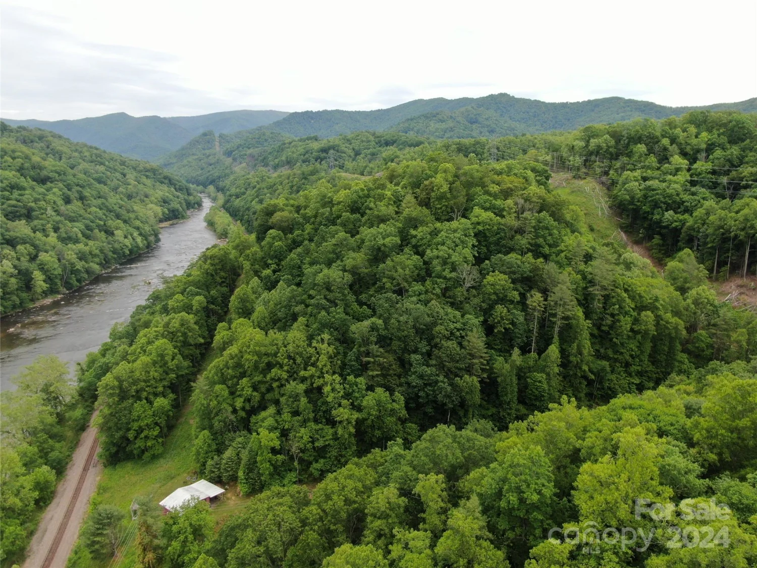
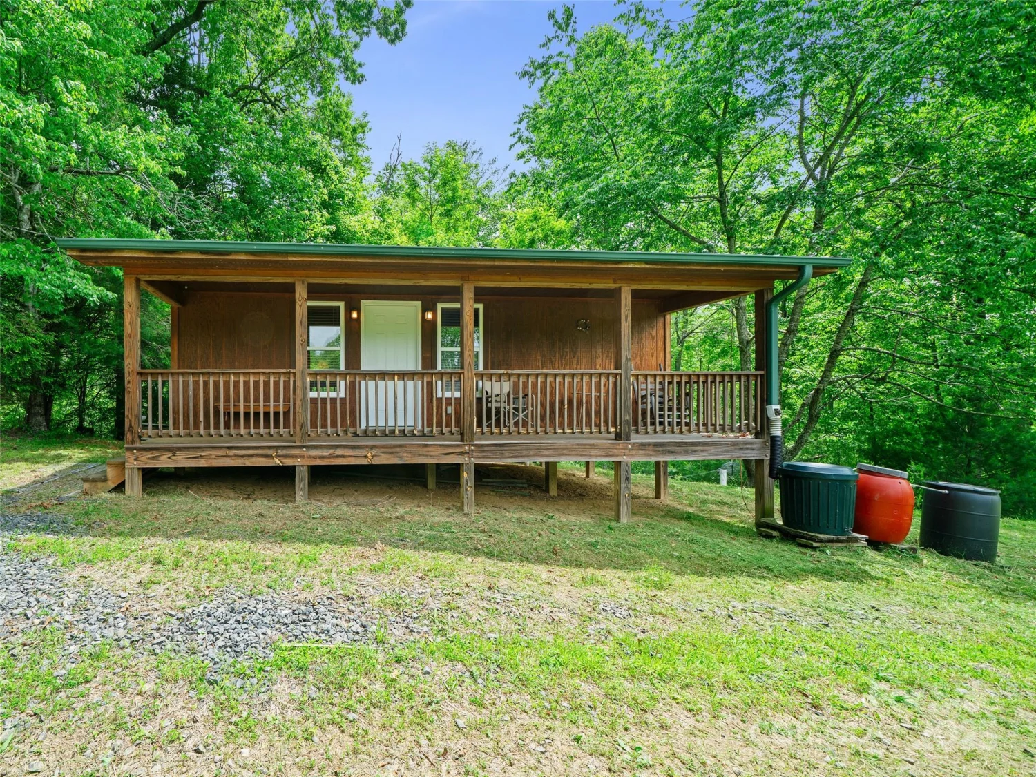
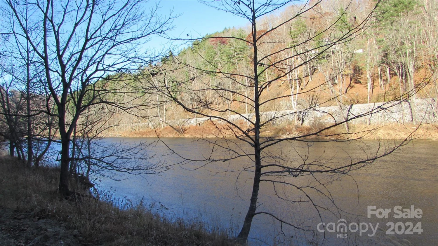
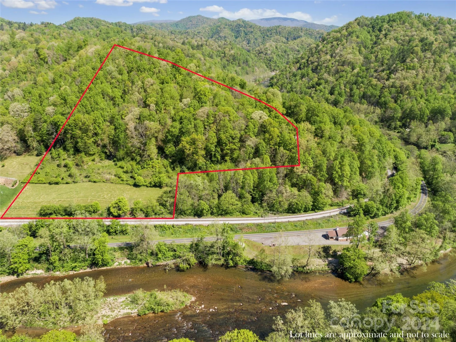
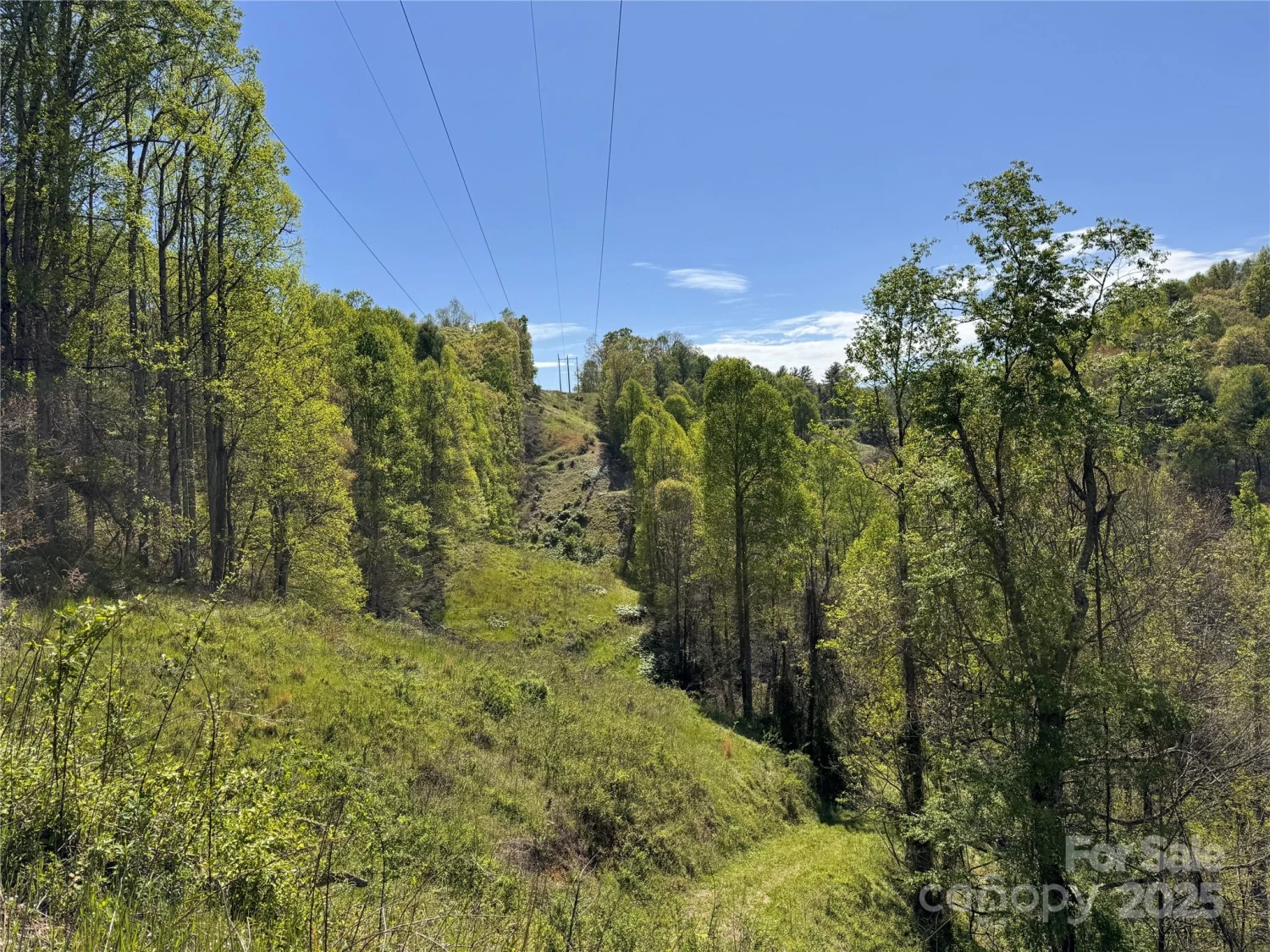
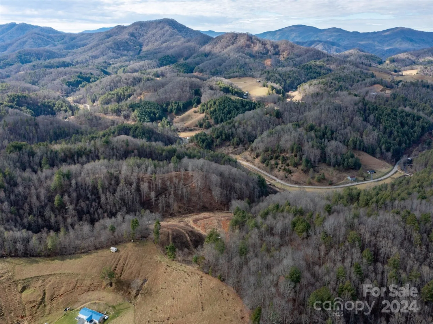
Approximately 16.41 Acres which are unsold Lots of Laurel Highlands Subdivision that is gently laying wooded acreage offering multiple homesites. Property is restricted with no mobile homes allowed. Excellent opportunity to build homes for resale or just enjoy the peace and quiet of rural country living for your own personal use. Roadway is graded with good access to property but interior roadways on plat map need clearing (now overgrown) and requires gravel on undeveloped portion. There is easement for connecting Thomas Ridge Loop Road to State Road but is only short distance that is accessible on dirt road and balance of this roadway needs clearing & gravel. This is excellent acreage parcel or offers opportunity to resell portions not desired for personal use. Good investment opportunity! Property legal descriptions are per Exhibit "A" in attachments and includes unsold lots per DB 316/679 (Less Lot 1A) and DB 754/668 and DB 754/671 and plats as per Map Book 2/44 & 3/353.
Property Details for 0000 Thomas Ridge Loop
- ExteriorOther - See Remarks
- Property AttachedNo
- Waterfront FeaturesNone
LISTING UPDATED:
- StatusActive
- MLS #CAR4163628
- Days on Site182
- MLS TypeLand
- Year Built
- CountryYancey
Location
Listing Courtesy of Carolina Mountain Realty, Inc. - Wanda Proffitt
LISTING UPDATED:
- StatusActive
- MLS #CAR4163628
- Days on Site182
- MLS TypeLand
- Year Built
- CountryYancey
Building Information for 0000 Thomas Ridge Loop
- Year Built
- Lot Size0.0000 Acres
Payment Calculator
Term
Interest
Home Price
Down Payment
The Payment Calculator is for illustrative purposes only. Read More
Property Information for 0000 Thomas Ridge Loop
Summary
Location and General Information
- Community Features: None
- Directions: From Burnsville go Hwy 197 North approx. 9.4 miles to right on Double Island Road, continue on Double Island Road approx. 3.4 miles to right on Old Chestnut Mountain Road, continue on Old Chestnut Mountain Road to end of state maintenance, turn right on Thomas Ridge Loop to property on right and left at bend in roadway (part of Section C).
- Coordinates: 35.97379192,-82.21075742
School Information
- Elementary School: Micaville
- Middle School: East Yancey
- High School: Mountain Heritage
Taxes and HOA Information
- Parcel Number: 085200045905000
- Tax Legal Description: per legal description per DB 316/679 & 754/671 & Map 2/44 & 3/253
Virtual Tour
Parking
- Open Parking: No
Interior and Exterior Features
Interior Features
Exterior Features
- Horse Amenities: None
- Pool Features: None
- Road Surface Type: Dirt, Gravel, Other
- Pool Private: No
- Road Frontage Type: Private Road
- Other Structures: None
Property
Utilities
- Sewer: Septic Needed, None
- Utilities: Electricity Connected
- Water Source: Well Needed, None
Property and Assessments
- Home Warranty: No
Green Features
Lot Information
- Lot Features: Wooded, Other - See Remarks
- Waterfront Footage: None
Rental
Rent Information
- Land Lease: No
Public Records for 0000 Thomas Ridge Loop
Home Facts
- Beds0
- Baths-
- Lot Size0.0000 Acres
- StyleAcreage
- APN085200045905000
- CountyYancey
- ZoningNone