0 boylston highwayMills River, NC 28759
0 boylston highwayMills River, NC 28759
Description
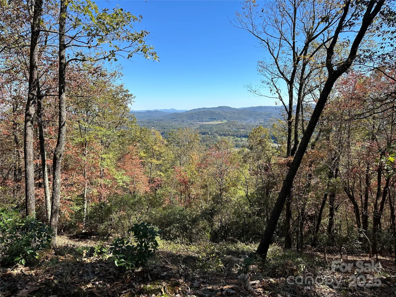
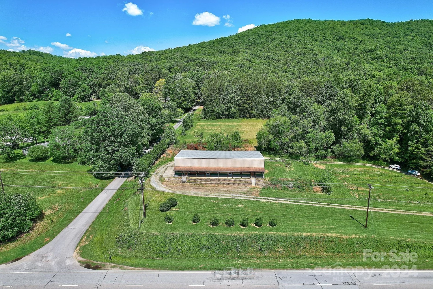
This 36 acre parcel Zoned for MR-MU. Comes with its relatively flat property with a few gentle slops, while also having two small creek's running down the property. While still offering limitless potential for agriculture, Commerce, or Residential use. The undulating landscape blends tranquility with practical advantages, making it an ideal canvas for various land uses. With a history of farming various crops, the acreage is a dream for agriculturists, promising bountiful harvests and sustainable practices. Its strategic location in Mills River, close to Asheville, Brevard, and Hendersonville, positions it perfectly for Multi-family or commercial development, ensuring close connectivity to markets and essential amenities. Additionally there is a possibility to hook-up city water and run underground utilities, and Fiber optics for internet. this is gem not often found in real estate. Don't let this one slip away, book your showing today!
Property Details for 0 Boylston Highway
- Subdivision ComplexNONE
- Property AttachedNo
- Waterfront FeaturesNone
LISTING UPDATED:
- StatusActive
- MLS #CAR4087571
- Days on Site524
- MLS TypeLand
- Year Built
- CountryHenderson
Location
Listing Courtesy of Big Hills Real Estate LLC - Vitaliy Antyufeyev
LISTING UPDATED:
- StatusActive
- MLS #CAR4087571
- Days on Site524
- MLS TypeLand
- Year Built
- CountryHenderson
Building Information for 0 Boylston Highway
- Year Built
- Lot Size0.0000 Acres
Payment Calculator
Term
Interest
Home Price
Down Payment
The Payment Calculator is for illustrative purposes only. Read More
Property Information for 0 Boylston Highway
Summary
Location and General Information
- Community Features: None
- Directions: For viewing the property coming From Asheville NC, take I-26E to Exit 40. Merge onto NC-280 W/Airport Rd Continue to follow NC-280 for 7 miles W Destination being on your left of Boylston highway, its a farm access road. the GPS coordinates are 35.37220,-82.58676
- View: Long Range, Year Round
- Coordinates: 35.339233,-82.631113
School Information
- Elementary School: Mills River
- Middle School: Rugby
- High School: West Henderson
Taxes and HOA Information
- Parcel Number: 10008054
- Tax Legal Description: EXEMPT SUBDIVISION 36.14AC PL2022-14204
Virtual Tour
Parking
- Open Parking: No
Interior and Exterior Features
Interior Features
Exterior Features
- Horse Amenities: None
- Pool Features: None
- Road Surface Type: Dirt
- Pool Private: No
- Road Frontage Type: Highway
- Other Structures: None
Property
Utilities
- Sewer: Septic Needed
- Utilities: Underground Power Lines, Underground Utilities, Wired Internet Available, Other - See Remarks
- Water Source: City
Property and Assessments
- Home Warranty: No
Green Features
Lot Information
- Lot Features: Cleared, Level, Open Lot, Rolling Slope, Sloped, Creek/Stream, Wetlands
- Waterfront Footage: None
Rental
Rent Information
- Land Lease: No
Public Records for 0 Boylston Highway
Home Facts
- Beds0
- Baths-
- Lot Size0.0000 Acres
- StyleAcreage
- APN10008054
- CountyHenderson
- ZoningMU